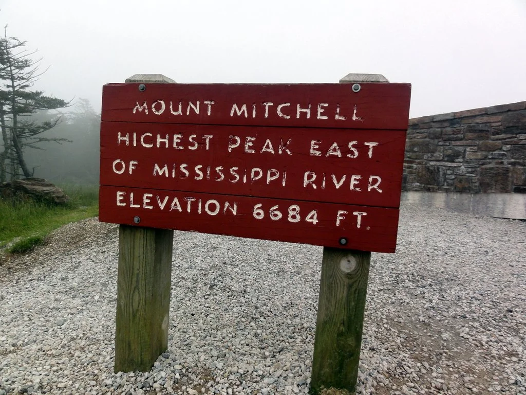
Mt. Mitchell
My definition of returning from a trip is when I have showered; thus, technically speaking, I have not yet returned from my trip to Mt. Mitchell, the highest point east of the Mississippi. As I write, I’m sitting in the Yancey County Library (a lovely library in a restored former prep school), hoping that no one sits too close to me.
The plan was to drive to the trailhead, park, camp a few feet down the trail, then set off to climb the Black Mountain Crest trail to the top of Mt. Mitchell and back – a feat that many people have described as very, very hard. The trail begins just south of Burnsville, North Carolina, and heads south and up (sort of like the opposite of the Nile) from just about 3100′ at the trailhead to 6130′ threeish miles later. As you might expect, it then follows the crest of the Black Mountains, rising and falling over that ridge’s many peaks and gaps. It ends up on Mt. Mitchell (6683′) 10 miles later. Total elevation, as one might expect, is a lot. Something over 5000′.
But, of course, things did not go according to plan. First, after scouting the trailhead, I found that my truck (a pansy-ass Ford Ranger, as a friend of mine once described it) might bottom out on the incredibly steep and rocky two track up to the parking area. One might wonder what the use of a parking area is if it’s not reachable by a perfectly respectable pickup truck.
So I couldn’t park at the trailhead, and I didn’t have anyone to drop me off, as I don’t know anyone in Burnsville. So, I would have to leave my car in an Ingles parking lot and walk or hitchhike the three miles to the trailhead. This didn’t seem like it would be particularly difficult, but as it was already 8pm, I decided it was a project for the next day.
This is how I found out that you can live surprisingly well in the parking lot of an Ingles supermarket. They have wifi, and lots of food (obviously) and a clean, pleasant restroom. The lights in the parking lot turn off at 11, and cars often spend the night there, disguising anyone sleeping in the back of their pickup truck. Apparently, I’m not the only homeless person who knows this – I shared my evening watching The West Wing in the Ingles Cafe with several real homeless people who showed me, among other things, that smoking is allowed in Ingles supermarkets, though not near the firework display.
After a lovely evening in the back of my pickup truck, I spent the morning sending emails, packing my food, and gathering up my gear. I ate a last civilized lunch, and started my hike to the trailhead, but I caught a ride before I left the parking lot. So far, so good.
It was around 1pm that I arrived at the trailhead, and I decided not to start my hike up the mountain until the next day. There are very few good campsites along the Black Mountain Crest trail due to lack of water on top of the ridge, and I didn’t think I could make it to the next one before nightfall.
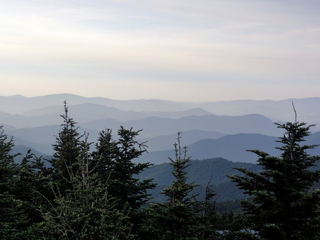
Early the next morning, however, I began to drag myself up the mountain. I expected the worst, but in fact the trail follows and old road grade, and while it is long and steep, it is not unbearably so. Still, it was an immense climb – I began in a warm, sunny hardwood forest surrounded by reddening blackberries, and as I climbed, entered by gradations a cold, misty forest of balsam fir and newly-opened blackberry flowers. Climbing to the top of the mountain always gives me an eery feeling that I’ve entered the twilight zone – it feels as though I’m traveling thousands of miles north or several months into the past.
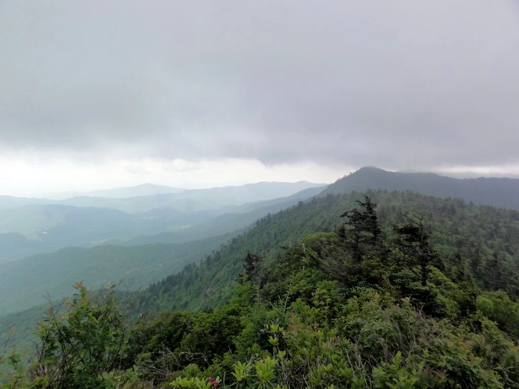
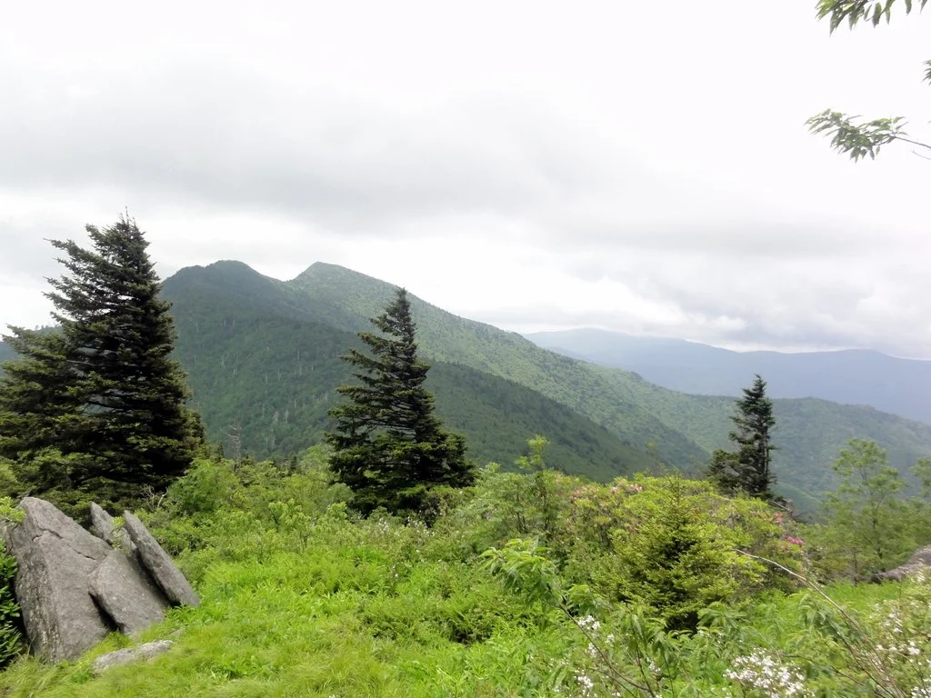
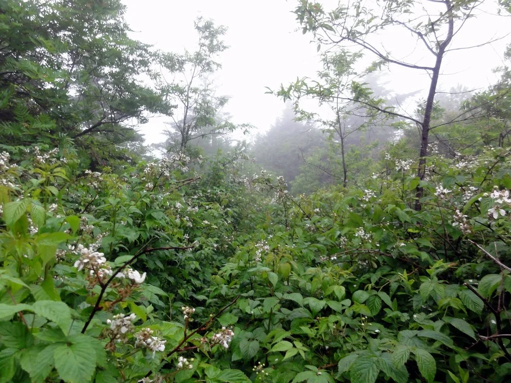
I have never enjoyed the experience of being inside a fast-moving cloud, and this hike along the ridgetop was no exception. It was cold, windy, and wet. Blackberry bushes taller than me had entirely overgrown the trail, and it was impossible to see where I was putting my feet, or more than 30 feet ahead along the trail. I was constantly worried that the trail would peter out, leaving me lost in a blowing mist, but fortunately, the trail rejoined a two track just beyond Celo Knob (probably the world’s largest blackberry patch – I’d recommend hiking up there sometime in late August). For a while, I was cruising, thinking that all this talk about the toughest trail in the East was a load of nonsense.
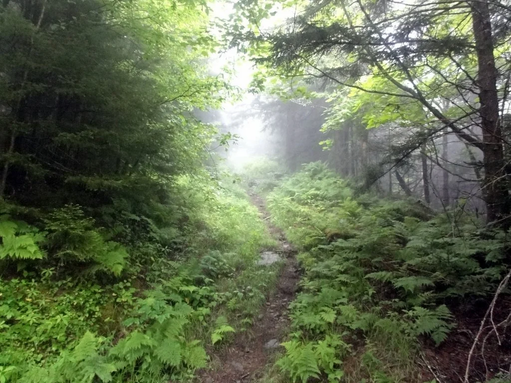
Of course, I was wrong. The ridge narrowed, and the trail left the road, and began a maddening rollercoaster ride between the east and west sides of the ridge as immense boulders forced it off the side, then back over the top, then down the other side. The topo on my map recorded none of this, as its contour interval is 50′. Turns out you can fit a lot of steep, wet, overgrown scrambling between two 50′ contour lines. I often had to throw my hiking stick up or down rock piles to free my hands; there were two points, both on the North side of Winter Star Mountain, where someone had tied a rope to a tree at the top to make the ascent possible.
The "trail"
I stumbled into Deep Gap exhausted. It was only 1:15, but I was ready to call it a day. I had read that there was a spring around Deep Gap – one of maybe two places on the trail where I could camp.
Unfortunately, I couldn’t find it, and in any case, the wind was wrapping Deep Gap in its soggy embrace, and I decided that my legs could handle a few more miles of hiking, if only to escape that cold and wet hellhole. I set off, and immediately ran into a guy who had spent there, cold and wet and without water. He told me my plan was a fantastic one, but warned me that the only legal campsite in Mt. Mitchell State Park (which I was about to enter) was two more miles beyond the peak, making my hike to a designated campsite 6 miles instead of 4. Obviously, I was not going to do that, especially considering that there is not just water at the summit, but running water (!). I figured I would slip quietly into the woods and set up my hammock where no one would find me.
The next four miles were horrible. Every peak in the state park is over 6500′, and they are all wickedly steep. After a brief moment of brightness before deep gap, the clouds had only thickened, and as I climbed Big Tom (with two rope-assisted sections of sheer rock), it began to rain.
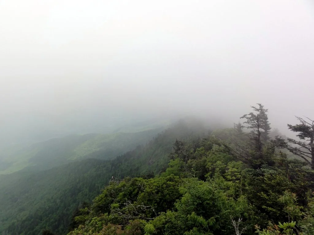
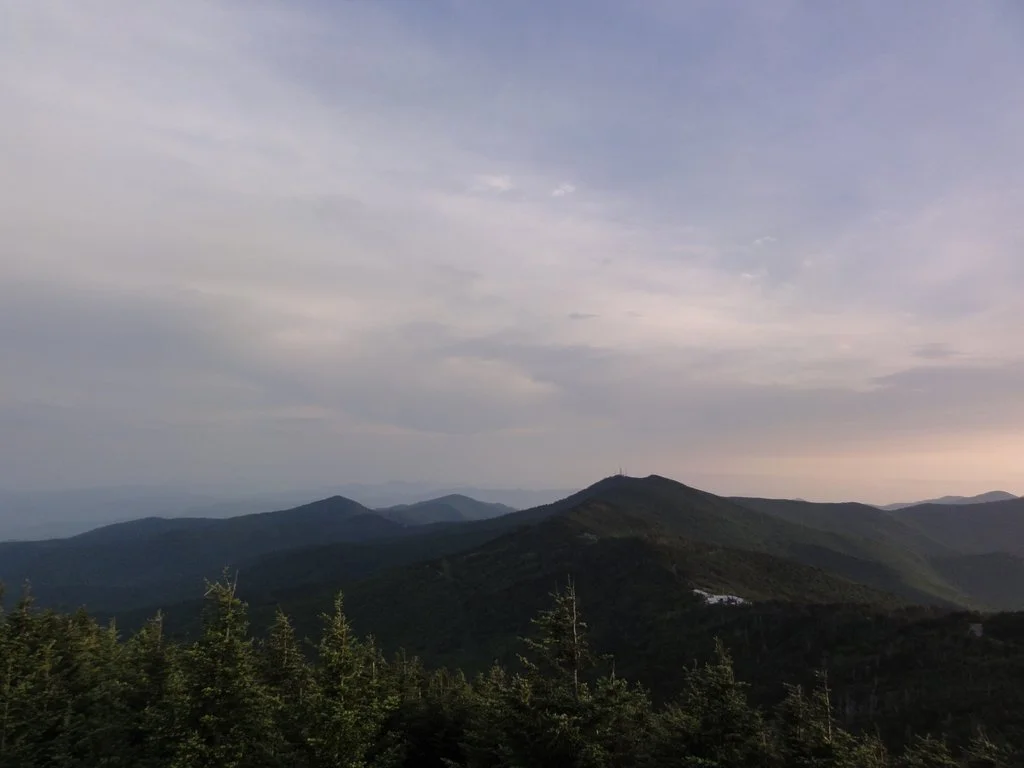
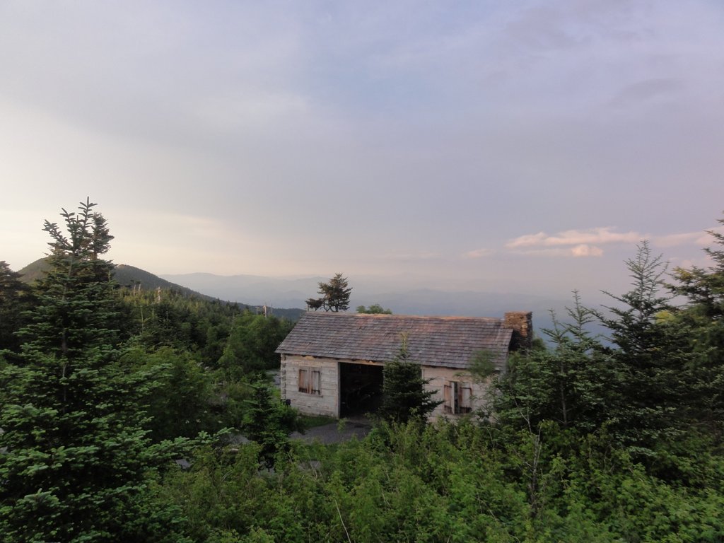
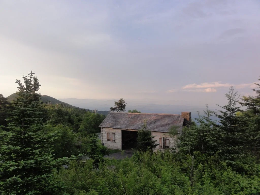
It had stopped raining by the time I reached Mt. Mitchell, but as the mountain was still in a cloud, there wasn’t much of a view to reward my arduous hike. It was 4:30, and I went about scouting places to bivouac. There were many, but the most attractive were the picnic huts, and given that the park was practically deserted, and given the state of parks funding in North Carolina, I didn’t think it was very likely that someone would catch me.
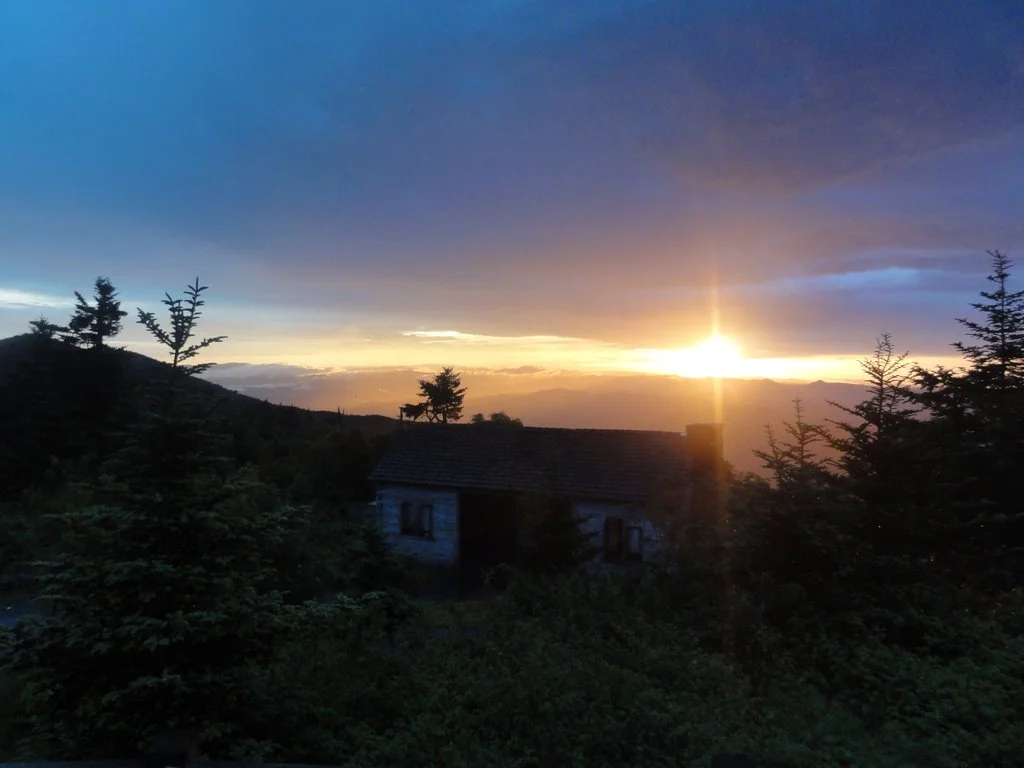
I cooked a delicious dinner of chili, and lay in my hammock to read. Some time passed, and I noticed that the wind had stopped blowing , and that I could suddenly see much further than before. I walked outside and saw that the sky had cleared as sunset approached. I hiked to the observation tower on the summit and soaked in the astounding view of countless darkening ridges fading into the distant night.
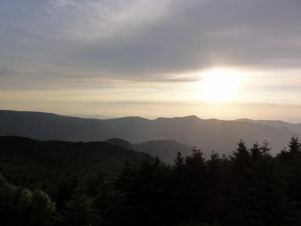
I awoke the next morning to a bright red light filling my hut; initially, I thought it was a fire, but quickly realized I was witnessing an incredible sunrise. I watched the red orb rise in silence until it slipped behind a low, gray cloud. This was the last I was to see of the sun until I climbed off the mountain.


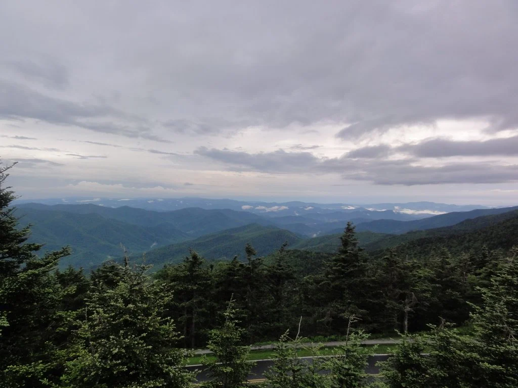

The day was more or less the same as the day before – I was hiking the same trail, and the weather was just as bad, if not slightly worse. It wasn’t quite as cold, but the wind was stronger – strong enough to knock me to my feet twice, which is especially concerning when one is hiking on a ridge no wider than my arm span. Fortunately, these gusts didn’t come in those sections, but it was an unnerving and unpleasant experience all the same. I had lunch under the drippiest tree I have ever seen, thinking that it would keep me drier, and began my descent from Celo Knob to the trailhead.
I don’t know if you have ever walked 6000 consecutive downhill steps, but I can assure you, it is just as terrible as you imagine. Perhaps worse. My left knee was aching before I finished the first switchback; 90 minutes later, even after a heavy dose of ibuprofen and a couple rests, I was seriously considering hopping the last bit on my right leg only. I would stop to rest my knee, trying to devise a plan to finish the descent, only to determine, again, that I had only one option – keep walking. On the bright side, my former blister was not bothering me, and as I descended, the wind stopped and it became quite warm, almost sunny even.
Of course, there was no car waiting for me at the trailhead. It was about 2pm, and I still had 3.2 miles along Bowlen’s Creek road before I reached the supermarket parking lot. I hoped that someone would pick me up, but as cars passed me, my hope soon dwindled to nothing. On my way out, apparently, I had met the one decent man in Burnsville. Of course, if I were driving, I probably wouldn’t have picked up someone who looked as wet and dirty as I did.
As I approached the town, it began to rain, which was actually a blessing, as it was very hot, and I needed something to wash off the dirt. A few minutes later, and I was reunited with my car. I dried off in the Ingles parking lot, ate the Ingles deli’s surprisingly good hot wings, and prepared for another night in the back of my pickup truck.
Reading back through this, I’m starting to realize just how awful this trip sounds. In some ways, it certainly was, but then, in some ways, all trips are terrible. You’re uncomfortable, dirty, wet, sweaty, hungry, tired, sore, and out of your element – and that’s what makes it exciting, interesting and worth doing. As someone once said, the distinguishing feature of an adventure is that it’s no fun at all while you’re having it. Put another way, no one wants to hear about a hiking trip that goes well. This one is certainly no exception. Hopefully, I’ll find a shower tonight.